Share this page:
The Atherton Tableland is a plateau (tableland) just southwest of Cairns, north Queensland. It is part of the Great Dividing Range, a series of mountains which runs down the eastern seaboard of Australia. The altitude of the Tablelands ranges from 500 to 1,280 meters (1600 to 4200 feet) above sea level.
Though in the tropics, the Atherton Tableland’s high elevation and mild climate along with its fertile volcanic soils mean the area is used by dairy farmers.
The area has several rivers of which the principal is the Barwon River. The Barwon has been dammed by the Tinaroo Dam to prevent monsoonal flooding down at Cairns and to provide water for water for irrigation. The Tinaroo Dam is accompanied by the small Tinaroo Hydro which produces some electricity for the local area.
Apart from dairy farming, agricultural activities on the Atherton Tableland include the growing of avocado, banana, citrus fruits, corn (maize), macadamia nuts, strawberries, and sugar. Other farming activities include cattle grazing and poultry farming.
The biggest towns on the Atherton Tableland are Atherton and Mareeba. Smaller towns include Herberton, Kuranda, Millaa Millaa, Malanda, Tinaroo, Ravenshoe, and Yungaburra
Fauna and Flora
There are many interesting bird species on the Tableland include the Sarus Crane and the Bush-stone Curlew. There are quite a few small remnants of rainforest which now protected inside National Parks.
Tourism
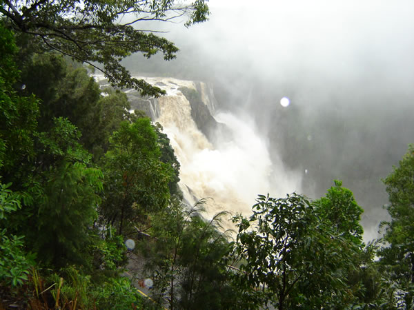
Tourism is an important economic activity in the area. Some of the better known tourist destinations include the town and station of Kuranda (an interesting train trip up from Cairns), the curtain fig tree at Yungaburra, Lake Barrine, Lake Eacham, Mount Hypipammee Crater and Dinner Falls, Undara National Park, and Hann Tableland National Park.
A Little History
The area was first explored by Europeans in the 1870s, first by J V Mulligan and then by John Atherton, after whom the tableland draws its name. Atherton discovered tin deposits and a small tin rush followed. The abundant rainforests were then eyed for their economic potential and much money was made cutting down stands of redcedar, kauri, black bean, maple, white beech and white tulip oak for use in building.
A number of Chinese, who had come down from the Palmer River goldfields, gathered in the Atherton area and worked initially in agriculture (market gardening and maize growing), timber getting and dairying. The timber and iron Hou Wang Temple (built in 1903 and one of the oldest original Chinese temples in Australia) is a reminder of the Chinese presence on the Tableland in those days.
During World War II, many Australian troops camped around the Atherton area while awaiting transport to the battlefront.
Share this page:
Author: David Paul Wagner
(David Paul Wagner on Google+)